• Welcome to Jetboaters.net!

    We are delighted you have found your way to the best Jet Boaters Forum on the internet! Please consider Signing Up so that you can enjoy all the features and offers on the forum. We have members with boats from all the major manufacturers including Yamaha, Seadoo, Scarab and Chaparral. We don't email you SPAM, and the site is totally non-commercial. So what's to lose? IT IS FREE!

    Membership allows you to ask questions (no matter how mundane), meet up with other jet boaters, see full images (not just thumbnails), browse the member map and qualifies you for members only discounts offered by vendors who run specials for our members only! (It also gets rid of this banner!)

    free hit counter

Is the great loop possible on a Yamaha?

Apologies if this was you, but I don't recall reading about this here for quite some time - I thought there was a member here who was doing what you propose, hitting parts of this over time, where the occasion would provide opportunities for him.

Sounds like a great experience!

 
Last edited:
There would be no problems finding fuel in that stretch of the loop. There’s marinas everywhere down here with fuel
Aight… Guess it was a route where people cut across that section 🤷🏼‍♂️.
 
Id like to sail from CA to Hawaii as my first long distance adventure!

A guy from San Diego I know from the “Beneteau First S series group” on Facebook has been asking me to do the run to Hawaii for years. Same 35’ Beneteau that we sailed here. Telling him the boat is too small for that and it is a coastal cruiser, not a blue water boat.
 
Just watched the YouTube @Betik posted of the Chicago to Peoria run and saw all the debris in the water at the locks..

@Speedling mentioned a trolling motor as a possibility of equipment and I had forgotten about how I used mine to take me through a debris field with the engines off at the entrance to the canyon where Rainbow Bridge is on Lake Powell. So in addition to having some extra range a troller could take you through a debris field with the engines off to avoid getting a stick stuck in the pump.

@Speedling also mentioned about a troller providing some navigation duties, this is possible at speeds up to 5-7 mph, maybe a bit faster, the boats engines would be providing most of the thrust with the troller at a low prop speed to provide directional control, this is also a great way to dramatically extend the capacity of the batteries. I know the Garmin MFD’s will work with their brand of trolling motors, there was another brand of troller that will work with Lowrance MFD’s, and my Hummingbird Solix (as well as other Humminbird models) will work with the Minnkota trollers with IPilot to provide directional control.

MFD’s;
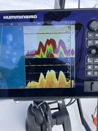
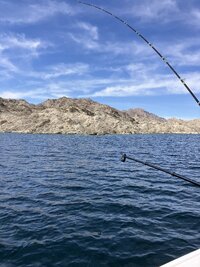
Some reading I was doing a couple months ago confirmed that the Humminbird MFD’s with the Lake Master map chips have the best charts in regards to underwater terrain and hazards. Any MFD one buys for their boat should have water offset, meaning the ability to set the water level / depth, if the lake is down 10’, you go into the settings and set the offset to -10’, on the Humminbird with the Lake Master chips, this will then set all of the depths accordingly for charts. The Humminbird units come with what looks like Navionics charts and the water level off set also works with these charts. With the Humminbird, and I would imagine others but you’d have to verify, you can set depth ranges with a color overlay, it’s user set able for whatever depth you want, in water 5’ or less it’s shaded red, 5-10’ it’s shaded yellow, then I have another depth ranges of 20-40 shaded green for fish habitat. Point being, with a charting system like this it’s very easy to spot any hazard areas in regards to depth. While I can see the recreational boater not wanting a 2D fish finder, but the Down Imaging is something I’d think any boater would want. It gives a clear picture of what is beneath you. In an impounded lake / reservoir, there will be stands of trees, could be along the old river channel or all over, the down imaging will show you those trees, in addition to there being an icon on the chart itself or writing like “submerged trees”. One of the most dangerous things I’ve seen is in a reservoir where the water freezes in the winter, the trees that once stuck up out of the water have been sheared off by the ice and their tops are now just below the surface.

Not trees obviously, those are rocks with a few small trees.

IMG_7417.jpeg

What it looks like on the surface

IMG_7418.jpeg

Point being I can’t imagine being on the water without great charts and the ability to see what’s underneath the boat.
 
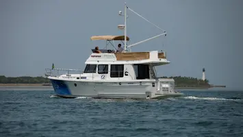
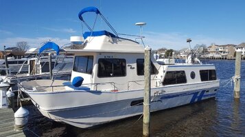
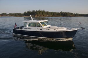
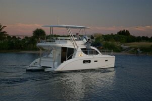
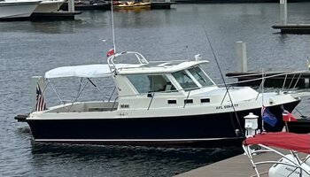
The Great Loop has been done in almost all kinds of watercraft, including jet skis, so it’s definitely doable in a Yamaha. The real question is do you really want to do a voyage of this length in a Yamaha? I day dreamed of doing the loop for a long time and I think at the minimum to do it comfortably you need either a cabin or full canvas on the boat, with both ideally. There are a lot of 28 - 32 boats that I would find comfortable for this journey. On a budget, however, I would do the loop in a C-Dory 22 with full canvas (camper top) over the cockpit. C-Dorys are pretty flat bottom boats and give excellent mpgs with decent speed.

Alas, I’ve pretty much given up the thought of the Great Loop but still am seriously thinking about a couple of weeks on the Trent Severn and Georgia Bay. I could do this journey on my 21’ Precision sailboat and it would be cheap and comfortable.

Jim
 
Back
Top